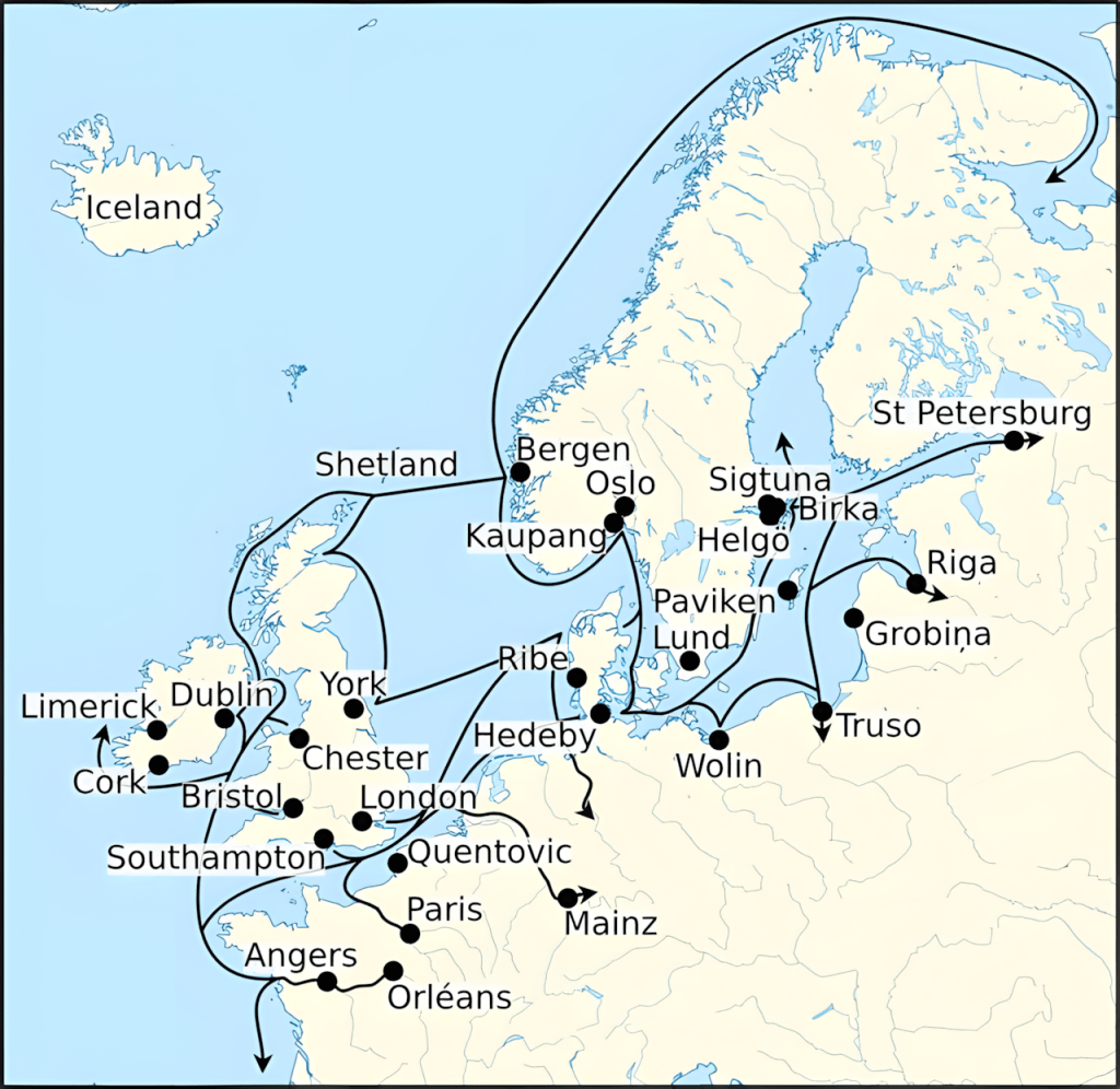
Map of Viking Age trade routes in north-west Europe, showing the main sea and river connections used to move amber, furs, glass beads, iron, silver and enslaved people between the Baltic, Scandinavia, the British Isles and the Continent.
These networks formed the backbone of Viking economic life, linking markets from Dublin to Hedeby and deep into eastern Europe.
북서유럽 바이킹 시대 무역로 지도다.
발트해 연안, 스칸디나비아, 영국 제도, 그리고 유럽 대륙 사이에서 호박amber, 모피, 유리 구슬, 철, 은, 그리고 노예들을 이동시키는 데 사용된 주요 해상 및 하천 연결망을 한 눈에 보여준다.
이러한 네트워크는 더블린에서 헤데비, 그리고 동유럽 깊숙한 곳까지 시장을 연결하며 바이킹 경제 생활의 근간을 이루었다.

댓글 남기기